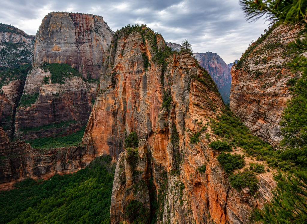
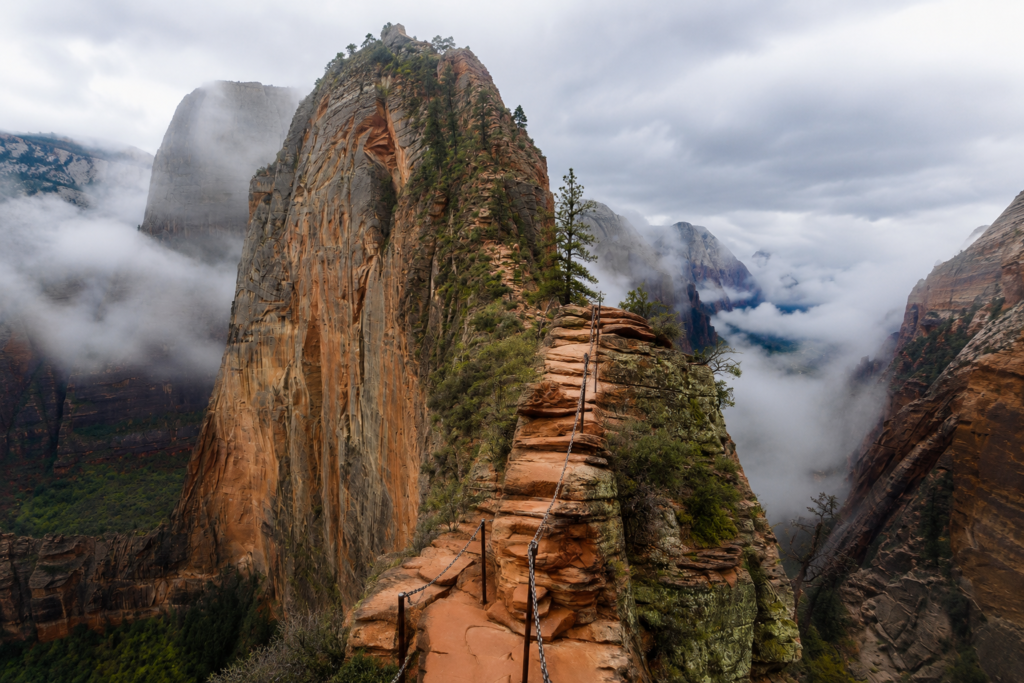
We stood at the bottom of this thing for a good ten minutes before we started walking. Just looking up at it. There’s a line of people up on that ridge, tiny, moving one at a time along what looks from the ground like a knife blade sticking out of the mountain. Ana said “absolutely not” and meant it. Four hours later we were both standing up there, hands shaking a little, already talking about coming back next year.
That’s basically the whole appeal of this trail in one sentence. It looks impossible from the ground and it isn’t, quite.
Why it’s called what it’s called
In 1916 a traveling Methodist minister named Frederick Vining Fisher rode into Zion Canyon on a stagecoach and looked up at this same rock formation, back then just called Temple of Aeolus after the Greek god of wind, not a name with much punch to it. Fisher looked at it and said something like “only an angel could land on it.” The name stuck immediately and Temple of Aeolus basically disappeared from use within a few years. Fisher named a lot of things in this park, actually, he had a real habit for it, but this is the one everyone still says a hundred years later.
Here’s the part most guides skip. In 1924, two years before there was any official trail up here at all, a park ranger named Harold Russell and a guide named David Dennett climbed it anyway. Ropes only, no chains, nothing bolted into the rock. They made it to the top and left a cairn with a scroll inside marking the ascent, and, for reasons nobody has ever explained well, a steer skull. We don’t know what that means either. But somebody hauled a skull up there in 1924 to prove a point, and that’s a better story than most trail histories manage to produce.
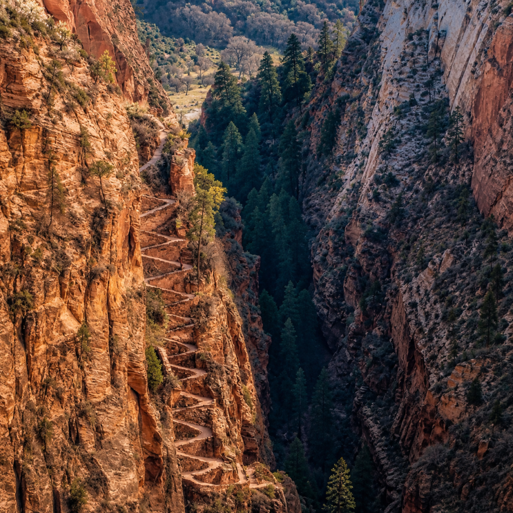
The actual constructed trail, the one with Walter’s Wiggles and the chains, came two years after that, finished in 1926 by two Park Service employees, Thomas Chalmers Vint and Walter Ruesch. Ruesch was Zion’s first superintendent, and the switchbacks are named after him, twenty-one of them, tight and steep, cut straight into the cliff face. The whole route got listed on the National Register of Historic Places in 1987, which, if you’ve ever gripped one of those chains at eight in the morning with your legs already shaking, feels like a strange kind of honor for something that regularly terrifies grown adults.
Getting the permit, which is its own hike honestly
Since a fatal fall in 2021, you need a permit for the chain section. There’s a seasonal lottery months out and a day-before lottery through the NPS app if you’re already in the area or didn’t plan ahead. We got ours through the day-before lottery, second try. First time we didn’t even get an entry in fast enough. A lot of people show up with zero plan for this and end up watching from the canyon floor while everyone else climbs. Sort this before you sort anything else about the trip.
The walk in
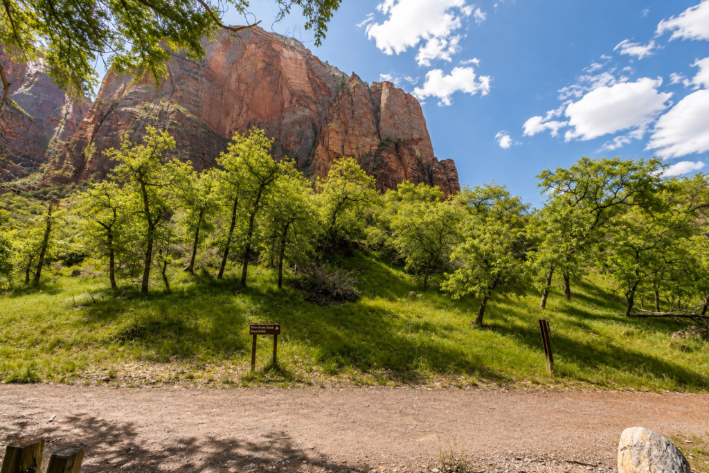
Starts at Grotto Trailhead, off the free shuttle, no driving allowed to this one during the season it matters. Cross the footbridge over the Virgin River and you’re climbing pretty much immediately, nothing gentle about the opening.
Walter’s Wiggles
Twenty-one switchbacks, steep, no exposure at all here, no chains needed, just straight uphill grind that puts a burn in your legs before the real test even starts. You pass through Refrigerator Canyon first, which earns its name, genuinely cooler air in there, a small mercy before the Wiggles start.
Scout Lookout sits at the top of the switchbacks. This is where a lot of people stop, and we mean that with zero judgment, the views from right here are already better than most entire hikes offer. It’s also the last point where quitting is easy and painless.
The half mile everyone actually came for
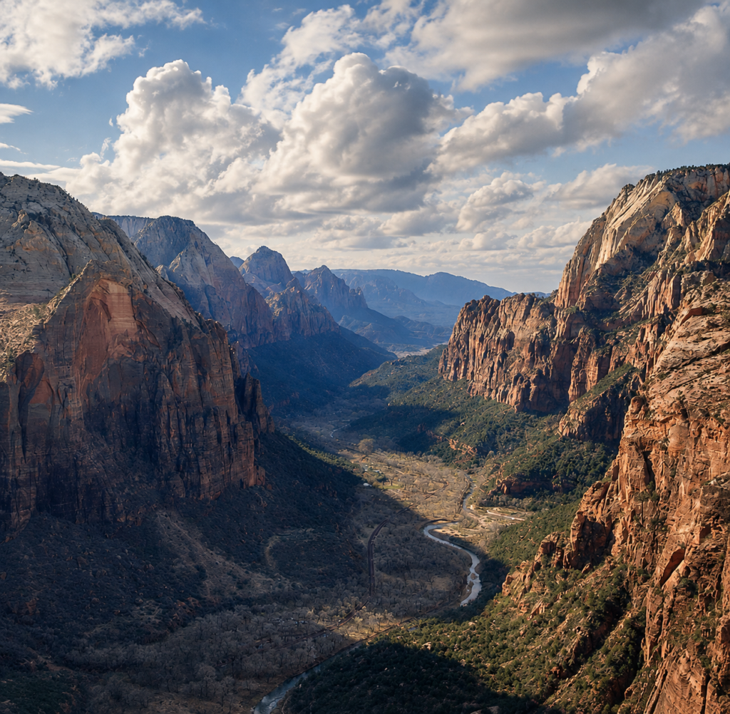
Past Scout Lookout the trail turns into a spine of sandstone maybe a few feet wide in places, drops on both sides that run over a thousand feet down. Chains bolted into the rock are what you’re actually holding. This section is not for everyone and there’s no shame in that. If heights genuinely mess with you, or the wind’s up, or there’s any wetness on the rock, this is where people get hurt, and people have died here, that’s not us being dramatic, that’s just the honest history of this specific half mile.
Then the trail just opens up and you’re on top, canyon spread out below in every direction, river looking like a thin green thread way down there, people on the valley floor small as gravel. A hundred years of history got you here, a minister with a flair for naming things, a ranger who climbed it with rope and left a skull as proof, and a superintendent who figured out how to cut a trail regular people could actually survive.
When to go
Spring and fall, temperature-wise, no contest. Summer afternoons regularly push into the high 90s and there’s no shade at all on the exposed stretch, real heat risk if you’re not prepared. Winter brings ice onto the chains, and ice on a route like this turns a hard hike into something genuinely dangerous. If you’re set on winter, call the visitor center first and bring microspikes, don’t improvise this part.
What we’d actually tell a friend before they go
Start early, earlier than feels reasonable. Parking and shuttle lines only get worse through the morning, and you want to be off that exposed spine before any afternoon heat or storm risk builds.
Carry more water than seems necessary. Zero shade on the chains, and the walk down beats up tired legs worse than people expect going in.
Skip it entirely in high wind. We turned back once, two years before we finally summited, because the gusts made the chains feel genuinely unstable under our hands. The rock isn’t going anywhere. There’s always next season.
Download offline maps before you lose signal, AllTrails has worked fine for us here, cell service just disappears once you’re in the canyon proper.
Bottom line
Angels Landing earns every bit of its reputation, the views and the actual risk both. It’s not something to walk into casually, and it’s also not something to talk yourself out of purely from fear, so long as you respect exactly what it’s asking of you. Get the permit sorted first, pick a calm weather day, and give yourself more time on the way down than feels necessary.
Did your permit come through on the first try, or did it take you a few attempts like it did us? Tell us in the comments, curious how the lottery’s been treating people lately. 👇