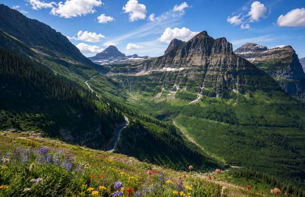
Glacier calls this one moderate. First quarter mile in, you’re on a ledge carved into the side of the Garden Wall with a hundred-foot drop toward the road below and a steel cable bolted into the rock for you to hold onto if you want it. Moderate is doing some quiet work in that sentence.
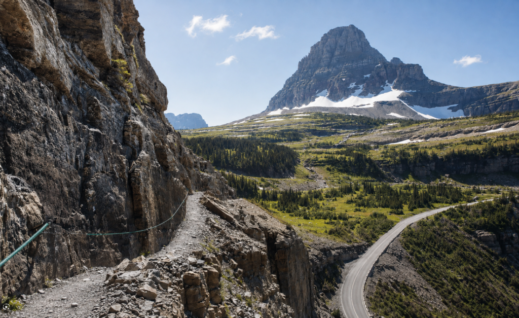
Once you’re past that first stretch, though, the trail settles into something genuinely different from the white-knuckle hikes most people put on a bucket list. This is mostly a walk. A long, high, spectacular walk along the Continental Divide, with almost none of the technical exposure. It’s the rare trail that’s both a serious full-day undertaking and something a reasonably fit person can enjoy without their heart rate spiking every ten minutes.
The basics
Full point-to-point route from Logan Pass to The Loop runs 11.6 miles, gaining about 800 feet and losing roughly 3,000 along the way, mostly downhill by the numbers even though it doesn’t always feel that way underfoot. Most people budget 5 to 7 hours. No permit needed, which is a nice change of pace if you’ve hiked anything else on this list. You do need to get yourself to Logan Pass, and during peak season that means either an early start or the free park shuttle, since parking up there fills fast.
The trail only exists in its hikeable form when Going-to-the-Sun Road itself is open, which is typically late June or early July through mid-October depending entirely on snowpack. Call ahead or check the park’s road status before you build a whole trip around this one.
Where the trail actually goes
After that opening ledge and cable, the trail runs relatively flat for a couple of miles, hugging the base of the Garden Wall with Heavens Peak and the Lake McDonald valley opening up to the west. At about 3.6 miles you hit Haystack Pass, a short, steep switchback climb of around 275 feet to a saddle at 7,024 feet between Haystack Butte and the shoulder of Mount Gould. A lot of hikers treat this as the day’s real destination, eat lunch, and turn back for a 7.2 mile round trip that’s noticeably easier than pushing on.
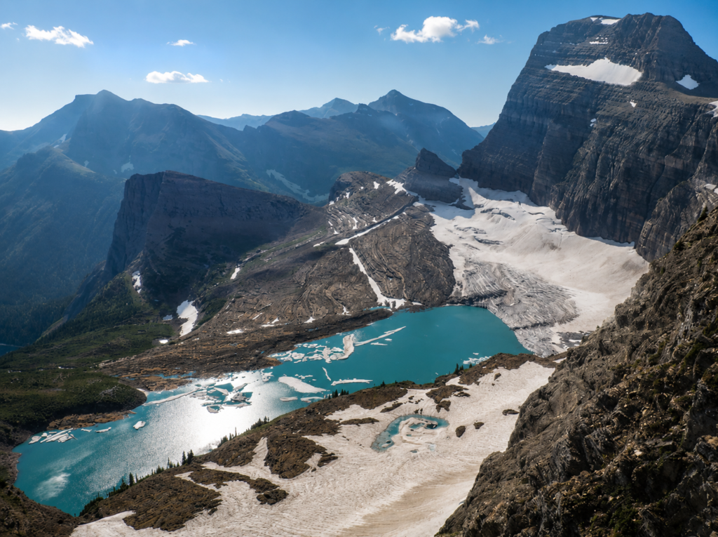
If you keep going, the crowds thin out fast past Haystack. Around 6.6 miles in, you’ll hit the junction for the Grinnell Glacier Overlook, a punishing side trip that gains close to a thousand feet in about six-tenths of a mile to a view of Grinnell Glacier and the far side of the Divide. It’s optional, and it’s brutal, and multiple people we’ve talked to who’ve done it describe it in almost identical terms: worth it, would not do again on the same day as the full Highline.
From there the trail begins its real descent toward Granite Park Chalet, appearing in the distance well before you reach it, at 7.6 miles from Logan Pass.
The chalet, and the part of its history nobody puts on the postcard
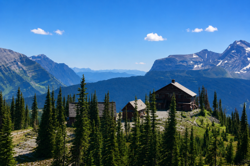
Granite Park Chalet was built in 1914 and 1915 by the Great Northern Railway, the last of nine backcountry chalets the railroad built across Glacier to get wealthy tourists off trains and onto horseback tours of the park. It’s one of only two of those original chalets still standing today. The Park Service bought it from the railway in 1954 for one dollar, which is either the best real estate deal in Montana history or a sign of how little anyone wanted to maintain a stone building with no road access at 6,700 feet.
Here’s the part of the history that actually matters for anyone hiking through today. In August 1967, staff at Granite Park had spent the summer dumping garbage a couple hundred yards from the chalet, partly out of necessity, partly because tourists loved watching grizzlies show up to feed on it. On the night of August 12th, a bear that had grown used to that food source attacked and killed a 19-year-old named Julie Helgeson at a campsite near the chalet. In an almost unbelievable coincidence, a second grizzly killed another 19-year-old, Michele Koons, at Trout Lake ten miles away that same night. Two fatal attacks, same night, different bears, after fifty-seven years without a single one in the park’s history.
That night became known as the Night of the Grizzlies, and it’s the direct reason backcountry food storage rules exist in national parks today, at Glacier and basically everywhere else. The garbage feeding stopped immediately. Bear canisters, food hangs, “pack it in, pack it out,” all of it traces back partly to two deaths in one night in this exact spot. We’re not telling you this to spook you off a genuinely great hike. We’re telling you because the rule you’ll read on every trailhead sign about food storage isn’t bureaucratic caution, it’s a lesson that got learned the hardest way possible, right where you’ll be standing.
On the subject of bears, since we’re already here
This is grizzly country, full stop. Rangers will tell you to skip the bear bells, they don’t work the way people think and some locals call them dinner bells since the sound seems to make bears curious rather than cautious. Use your voice instead, especially around blind corners and creek crossings. Hike with other people if you can. Carry bear spray and know how to use it before you need to.
Getting back
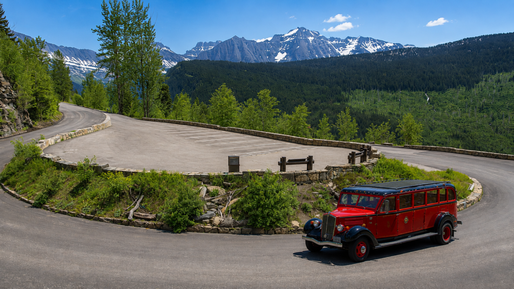
Most people end at The Loop rather than hiking back the way they came, which is what gives this trail its name despite not actually being a loop. The Loop is a bend in Going-to-the-Sun Road about 7.75 miles from Logan Pass by road, and the free shuttle connects both ends, so the usual plan is to park at The Loop, shuttle up to Logan Pass, and hike back down past your car. The final stretch from the chalet down to The Loop is steep and switchbacked and, by most accounts, the least scenic part of the day. Nobody’s out here for that section, they’re out here for everything before it.
What we’d actually tell you
Start early regardless of season. Afternoon storms build fast at this elevation and there’s no real shelter along most of the route.
Bring more water than the mileage suggests. There’s limited reliable water along the Garden Wall itself, and the sun exposure up here is intense with almost no shade.
If the full 11.6 miles feels like too much, Haystack Pass and back is a completely legitimate hike on its own, not a consolation prize.
And take the food storage rules seriously, not as a formality. This particular trail has a specific, documented reason why they exist.
Have you done the full Highline, or turned around at Haystack Pass? Let us know in the comments, always curious how far people push it. 👇